AIM
9/5/24
of air
−
to
−
air ADS
−
B are for “advisory” use only, enhancing a pilot’s visual acquisition of other nearby equipped
aircraft either when airborne or on the airport surface. Additionally, ADS
−
B will enable ATC and fleet operators
to monitor aircraft throughout the available ground station coverage area.
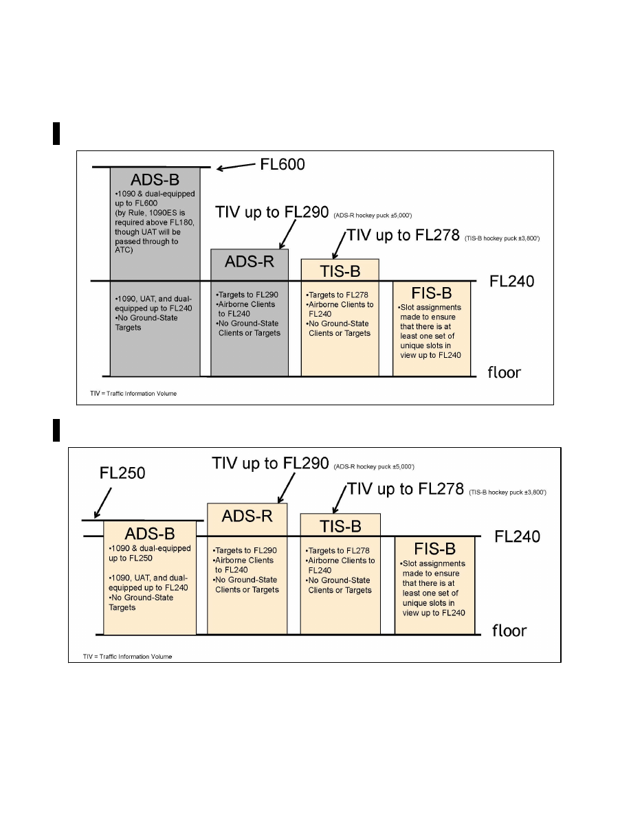
FIG 4
−
5
−
7
En Route
−
ADS
−
B/ADS
−
R/TIS
−
B/FIS
−
B Service Ceilings/Floors
FIG 4
−
5
−
8
Terminal
−
ADS
−
B/ADS
−
R/TIS
−
B/FIS
−
B Service Ceilings/Floors
2.
One of the data elements transmitted by ADS
−
B is the aircraft’s Flight Identification (FLT ID). The FLT
ID is comprised of a maximum of seven alphanumeric characters and must correspond to the aircraft
identification filed in the flight plan. For airline and commuter aircraft, the FLT ID is usually the company name
and flight number (for example, AAL3432), and is typically entered into the avionics by the flight crew during
preflight. For general aviation (GA), if aircraft avionics allow dynamic modification of the FLT ID, the pilot can
4
−
5
−
14
Surveillance Systems