AIM
4/20/23
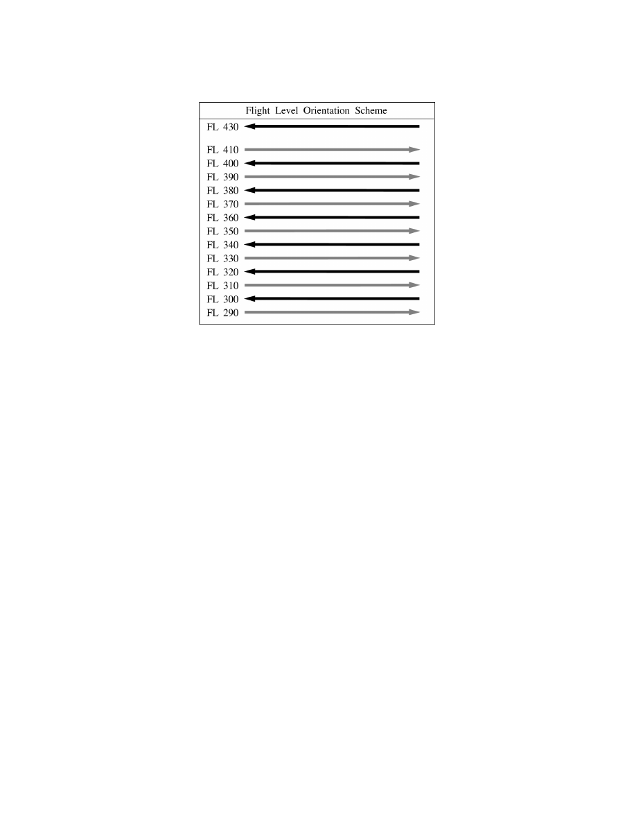
FIG 4
−
6
−
1
Flight Level Orientation Scheme
NOTE
−
Odd Flight Levels: Magnetic Course 000
−
179 Degrees Even Flight Levels: Magnetic Course 180
−
359 Degrees.
4
−
6
−
3. Aircraft and Operator Approval Policy/Procedures, RVSM Monitoring and Databases
for Aircraft and Operator Approval
a. RVSM Authority
. 14 CFR Section 91.180 applies to RVSM operations within the U.S. 14 CFR
Section 91.706 applies to RVSM operations outside the U.S. Both sections require that the operator be authorized
prior to operating in RVSM airspace. For Domestic RVSM operations, an operator may choose to operate under
the provisions of Part 91, Appendix G, Section 9; or if intending to operate outside U.S. airspace, hold a specific
approval (OpSpec/MSpec/LOA) under the provisions of Section 3 of Part 91, Appendix G.
b. Sources of Information.
Advisory Circular (AC) 91
−
85, Authorization of Aircraft and Operators for
Flight in Reduced Vertical Separation Minimum (RVSM) Airspace, and the FAA RVSM website.
c. TCAS Equipage.
TCAS equipage requirements are contained in 14 CFR Sections 121.356, 125.224,
129.18 and 135.189. Part 91, Appendix G, does not contain TCAS equipage requirements specific to RVSM,
however, Appendix G does require that aircraft equipped with TCAS II and flown in RVSM airspace be modified
to incorporate TCAS II Version 7.0 or a later version.
d. Aircraft Monitoring.
Operators are required to participate in the RVSM altitude
−
keeping performance
monitoring program that is appropriate for the type of operation being conducted. The monitoring programs
are described in AC 91
−
85. Monitoring is a quality control program that enables the FAA and other civil aviation
authorities to assess the in
−
service altitude
−
keeping performance of aircraft and operators.
e. Purpose of RVSM Approvals Databases.
All RVSM designated airspace is monitored airspace. ATC
does not use RVSM approvals databases to determine whether or not a clearance can be issued into RVSM
airspace. RVSM program managers do regularly review the operators and aircraft that operate in RVSM
airspace to identify and investigate those aircraft and operators flying in RVSM airspace, but not listed on the
RVSM approvals databases.
f. Registration of U.S. Operators.
When U.S. operators and aircraft are granted specific RVSM authority,
the Separation Standards Group at the FAA Technical Center obtains PTRS operator and aircraft information
to update the FAA maintained U.S. Operator/Aircraft RVSM Approvals database. Basic database operator and
aircraft information can be viewed on the RVSM Documentation web page in the “RVSM Approvals” section.
4
−
6
−
2
Operational Policy/Procedures for Reduced Vertical Separation Minimum (RVSM) in the
Domestic U.S., Alaska, Offshore Airspace and the San Juan FIR