NO.
NO.
AIM
4/20/23
FIG 6
−
2
−
1
Ground
−
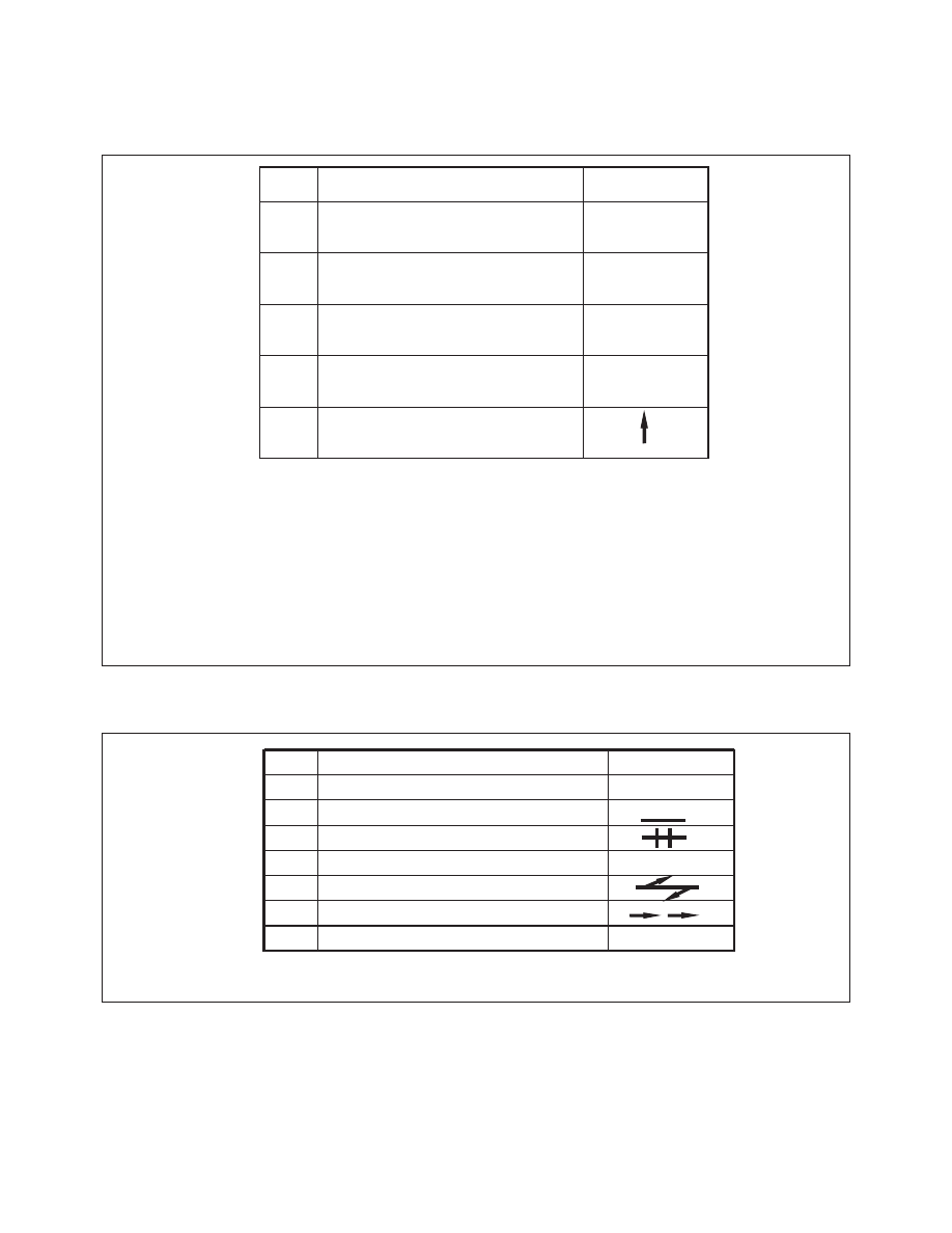
Air Visual Code for Use by Survivors
NO.
MESSAGE
MESSAGE
CODE SYMBOL
CODE SYMBOL
1
Require assistance
Require assistance
V
2
Require medical assistance
Require medical assistance
X
3
No or Negative
No or Negative
N
4
Yes or Affirmative
Yes or Affirmative
Y
5
Proceeding in this direction
Proceeding in this direction
IF IN DOUBT, USE INTERNATIONAL SYMBOL
IF IN DOUBT, USE INTERNATIONAL SYMBOL
S O S
INSTRUCTIONS
INSTRUCTIONS
1. Lay out symbols by using strips of fabric or parachutes, pieces of wood, stones, or any available material.
2. Provide as much color contrast as possible between material used for symbols and background against which symbols are exposed.
3. Symbols should be at least 10 feet high or larger. Care should be taken to lay out symbols exactly as shown.
4. In addition to using symbols, every effort is to be made to attract attention by means of radio, flares, smoke, or other available means.
5. On snow covered ground, signals can be made by dragging, shoveling or tramping. Depressed areas forming symbols will
appear black from the air.
6. Pilot should acknowledge message by rocking wings from side to side.
FIG 6
−
2
−
2
Ground
−
Air Visual Code for use by Ground Search Parties
CODE SYMBOL
CODE SYMBOL
NO.
MESSAGE
MESSAGE
1
Operation completed.
Operation completed.
L L L
2
L L
We have found all personnel.
We have found all personnel.
3
We have found only some personnel.
We have found only some personnel.
We are not able to continue.
We are not able to continue.
4
X X
Returning to base.
Returning to base.
Have divided into two groups.
Have divided into two groups.
5
Each proceeding in direction indicated.
Each proceeding in direction indicated.
6
Information received that aircraft is in this direction.
Information received that aircraft is in this direction.
7
Nothing found. Will continue search.
Nothing found. Will continue search.
N N
Note: These visual signals have been accepted for international use and appear in Annex 12 to the Convention on International
Civil Aviation.
Emergency Services Available to Pilots
6
−
2
−
8