AIM
4/20/23
FIG 7
−
1
−
2
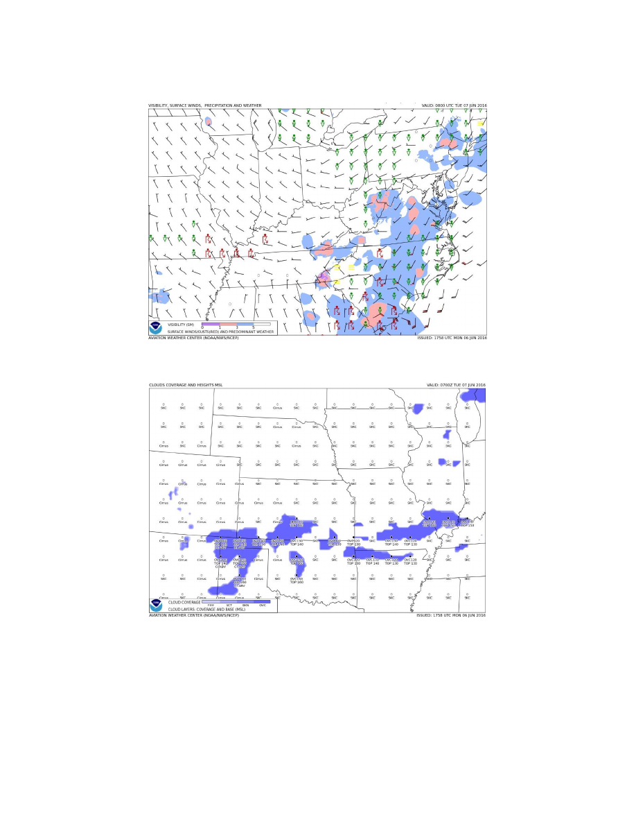
Aviation Surface Forecast
FIG 7
−
1
−
3
Aviation Cloud Forecast
7
−
1
−
5. Preflight Briefing
a.
Flight Service is one of the primary sources for obtaining preflight briefings and to file flight plans by phone
or the Internet. Flight Service Specialists are qualified and certificated as Pilot Weather Briefers by the FAA.
They are not authorized to make original forecasts, but are authorized to translate and interpret available forecasts
and reports directly into terms describing the weather conditions which you can expect along your flight route
and at your destination. Prior to every flight, pilots should gather all information vital to the nature of the flight.
Pilots can receive a regulatory compliant briefing without contacting Flight Service. Pilots are encouraged to use
automated resources and review AC 91
−
92, Pilot’s Guide to a Preflight Briefing, for more information. Pilots
7
−
1
−
8
Meteorology