AIM
4/20/23
1.
AIRMETs contain details about IFR conditions, extensive mountain obscuration, turbulence, strong
surface winds, icing, and freezing levels. Unscheduled updates and corrections are issued as necessary.
2.
AIRMETs:
(a)
Are intended to inform all pilots, but especially Visual Flight Rules pilots and operators of sensitive
aircraft, of potentially hazardous weather phenomena.
(b)
Are issued on a scheduled basis every 6 hours, except every 8 hours in Alaska. Unscheduled updates
and corrections are issued as necessary.
(c)
Are intended for dissemination to all pilots in the preflight and en route phase of flight to enhance
safety. En route AIRMETs are available over flight service frequencies. Over the contiguous U.S., AIRMETs
are also available on equipment intended to display weather and other non
−
air traffic control
−
related flight
information to pilots using the Flight Information Service–Broadcast (FIS
−
B). In Alaska and Hawaii, AIRMETs
are broadcast on air traffic frequencies.
(d)
Are issued for the contiguous U.S., Alaska, and Hawaii. No AIRMETs are issued for U.S. Oceanic
FIRs in the Gulf of Mexico, Caribbean, Western Atlantic, and Pacific Oceans.
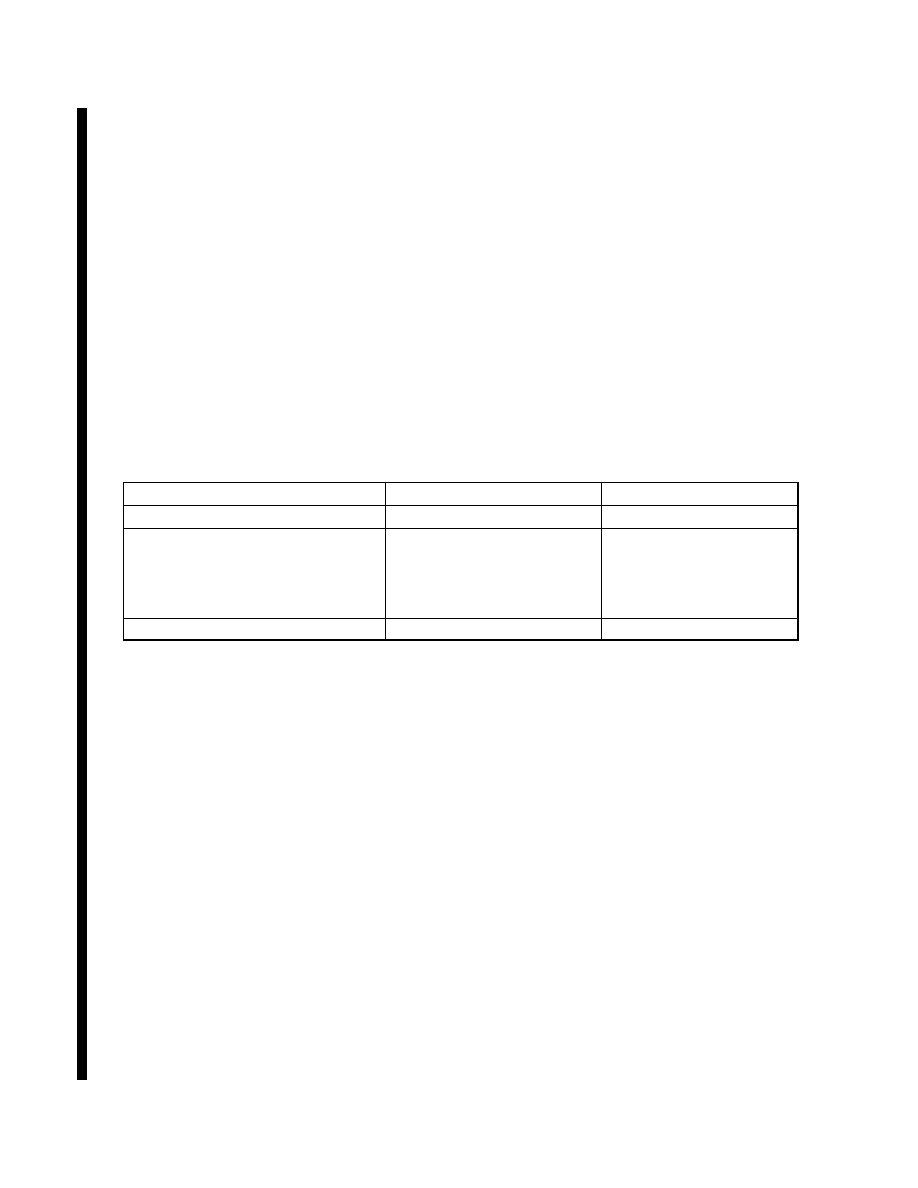
TBL 7
−
1
−
2
U. S. AIRMET Issuance Time and Frequency
Product Type
Issuance Time
Issuance Frequency
AIRMETs over the Contiguous U.S. 0245, 0845, 1445, 2045 UTC Every 6 hours
AIRMETs over Alaska
0515, 1315, 2115 UTC
(standard time)
0415, 1215, 2015 UTC
(Daylight savings time)
Every 8 hours
AIRMETs over Hawaii
0400, 1000, 1600, 2200 UTC Every 6 hours
3.
AIRMETs over the Contiguous U.S.:
(a)
Are displayed graphically on websites, such as, aviationweather.gov and 1800wxbrief.com, and
equipment receiving FIS
−
B information.
(b)
Provide a higher forecast resolution than AIRMETs issued in text format.
(c)
Are valid at discrete times no more than 3 hours apart for a period of up to 12 hours into the future
(for example, 00, 03, 06, 09, and 12 hours). Additional forecasts may be inserted during the first 6 hours (for
example; 01, 02, 04, and 05). 00
−
hour represents the initial conditions, and the subsequent graphics depict the
area affected by the particular hazard at that valid time. Forecasts valid at 00 through 06 hours correspond to the
text AIRMET bulletin.
(d)
Depict the following en route aviation weather hazards:
(1)
Instrument flight rule conditions (ceiling < 1000’ and/or surface visibility < 3 miles).
(2)
Widespread mountain obscuration.
(3)
Moderate icing.
(4)
Freezing levels.
(5)
Moderate turbulence.
(6)
Non
−
convective low
−
level wind shear potential below 2,000 feet AGL.
(7)
Sustained surface winds greater than 30 knots.
7
−
1
−
16
Meteorology