AIM
4/20/23
FIG 7
−
3
−
2
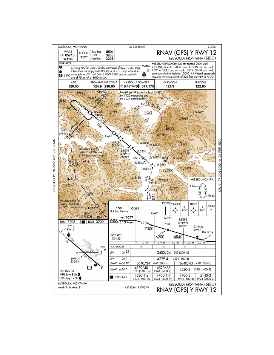
Missoula Intl RNAV (GPS) Y RWY 12
7
−
3
−
8
Cold Temperature Barometric Altimeter Errors, Setting Procedures and Cold Temperature
Airports (CTA)
AIM
4/20/23
FIG 7
−
3
−
2
Missoula Intl RNAV (GPS) Y RWY 12
7
−
3
−
8
Cold Temperature Barometric Altimeter Errors, Setting Procedures and Cold Temperature
Airports (CTA)