3/21/24
AIM
2.
No PBN/ code needs to be filed to indicate the ability to fly point
−
to
−
point routes using GNSS or INS.
3.
Filing one of these four area navigation capabilities as shown does not indicate performance based navigation sufficient
for flying Q
−
Routes, T
−
Routes, or RNAV SIDs or STARs. To qualify for these routes, see the section on Performance Based
Navigation Routes.
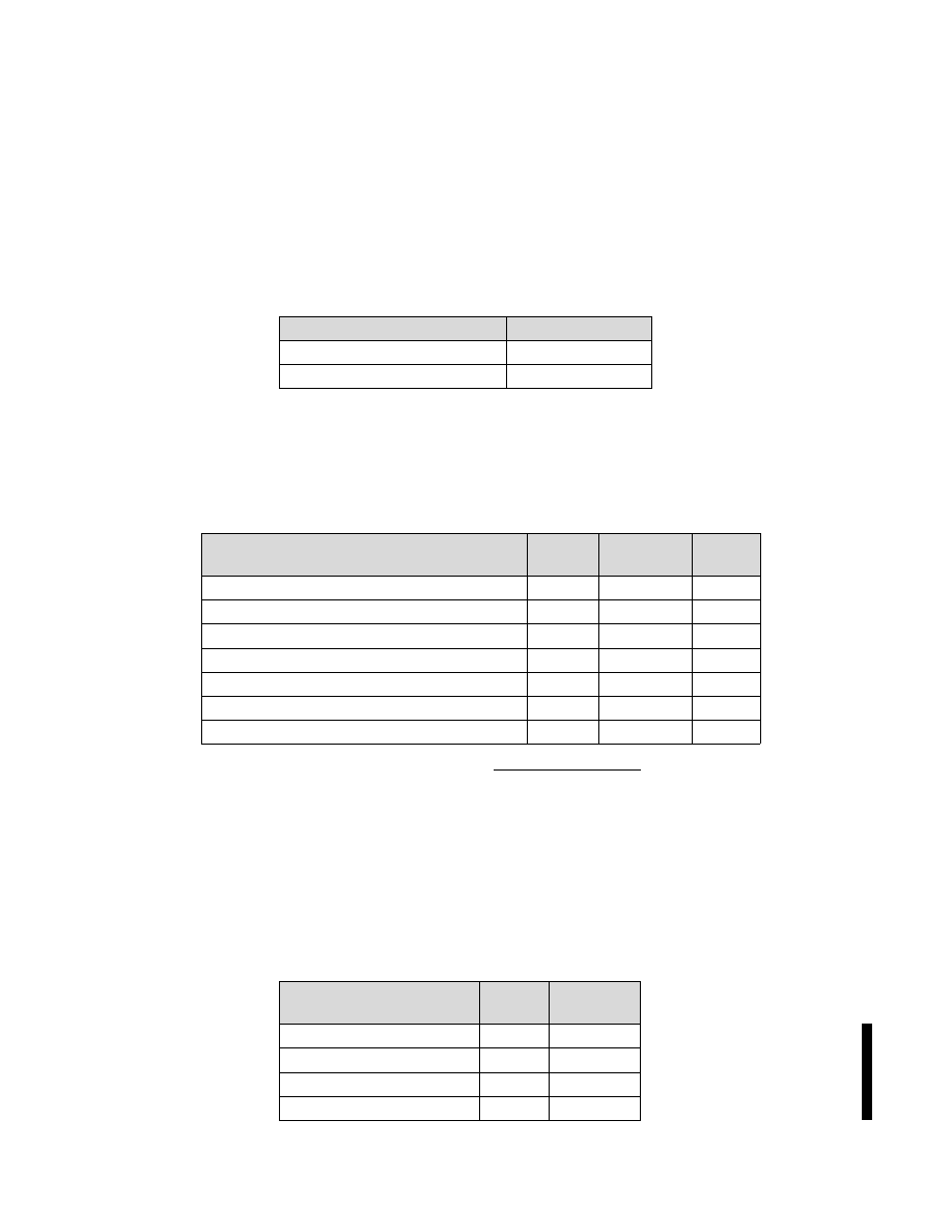
(c) Transponder Capabilities (Item 10b)
For domestic flights, it is not necessary to indicate Mode S capability. It is acceptable to simply
file one of the following codes in TBL 4
−
8.
TBL 4
−
8
Mode C
Capability
Item 10b
Transponder with no Mode C
A
Transponder with Mode C
C
International flights must file in accordance with relevant AIPs and regional supplements. Include
one of the Mode S codes in TBL 4
−
9, if appropriate.
NOTE
−
File only one transponder code.
TBL 4
−
9
Mode S
Capability
Aircraft
ID
Altitude
Encoding
Item
10b
Mode S Transponder
No
No
X
Mode S Transponder
No
Yes
P
Mode S Transponder
Yes
No
I
Mode S Transponder
Yes
Yes
S
Mode S Transponder with Extended Squitter
Yes
Yes
E
Enhanced Mode S Transponder
Yes
Yes
H
Enhanced Mode S Transponder with Extended Squitter
Yes
Yes
L
(d) ADS
−
B Capabilities (Item 10b, Item 18 SUR/ and Item 18 CODE/)
Indicate ADS
−
B capability as shown in TBL 4
−
10. The accompanying entry in Item 18 indicates
that the equipment is compliant with 14 CFR §91.227. Some ADS
−
B equipment used in other countries is
based on an earlier standard and does not meet U.S. requirements.
Do not file an ADS
−
B code for “in” capability only. There is currently no way to indicate that an
aircraft has “in” capability but no “out” capability.
For aircraft with ADS
−
B “out” on one frequency and “in” on another, include only the ADS
−
B
“out” code. For example, B1 or U1, (See TBL 4
−
10).
TBL 4
−
10
ADS
−
B Capabilities
Capability
Item
10b
Item 18
SUR/
1090 ES Out Capability
B1
A2
1090 ES Out and In Capability
B2
A2
UAT Out Capability
U1
A2
UAT Out and In Capability
U2
A2
FAA Form 7233
−
4
−
International Flight Plan
Appendix 4
−
9