AIM
4/20/23
TBL 4
−
19
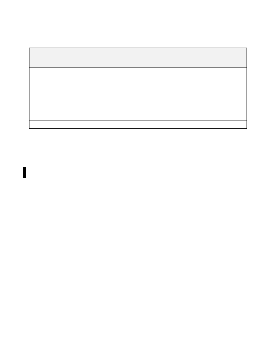
Aircraft Specific Information
Item
International Flight Plan
(FAA Form 7233
−
4)
Domestic U.S. Requirements
Equivalent Item on
Domestic Flight Plan
(FAA Form 7233
−
1)
Number of Aircraft
Item 9
Included when more than one a/c in flight
Item 3
Type of Aircraft
Item 9
Required
Item 3
Wake Turbulence Category
Item 9
Required
N/A
Aircraft Registration
Item 18 REG/
Include when planning to operate in RVSM
airspace
N/A
Mode S Address
Item 18 CODE/
Not required within U.S. controlled airspace
N/A
SELCAL Codes
Item 18 SEL/
Include when SELCAL equipped
N/A
Performance Category
Item 18 PER/
Not required for domestic flights
N/A
e. Instructions for Aircraft
−
Specific Information.
1. Number of Aircraft (Item 9)
when there is more than one aircraft in the flight; indicate the number of
aircraft up to 99.
2. Type of Aircraft (Item 9)
(a)
Provide the appropriate 2
−
4 character aircraft type designator listed in FAA Order JO 7360.1, Aircraft
Type Designators. FAA Order JO 7360.1 may be located at: Orders & Notices (faa.gov), then enter 7360.1 in
the Search box.
(b)
When there is no designator for the aircraft type use ’ZZZZ’, and provide a description in Item 18 TYP/.
3. Wake Turbulence Category (Item 9)
A Wake Turbulence Category is required for all aircraft types. Provide the appropriate wake turbulence category
for the aircraft type as listed in FAA Order 7360.1. The categories include:
(a) J
−
SUPER,
aircraft types specified as such in FAA Order JO 7360.1, Aircraft Type Designators.
(b) H
−
HEAVY
, to indicate an aircraft type with a maximum certificated take
−
off mass of 300,000 lbs. or
more, with the exception of aircraft types listed in FAA Order JO 7360.1 in the SUPER (J) category.
(c) M
−
MEDIUM
, to indicate an aircraft type with a maximum certificated take
−
off mass of less than
300,000 lbs. but more than 15,500 lbs.
(d) L
−
LIGHT
, to indicate an aircraft type with a maximum certificated take
−
off mass of 15,500 lbs. or
less.
4. Aircraft Registration (Item 18 REG/)
The aircraft registration must be provided here if different from the Item 7 entry. The registration mark must not
include any spaces or hyphens. Additionally, the actual aircraft registration must also be included if Item 7 would
have contained a leading numeric and was modified to be prefixed with the appropriate alphabetic character for
U.S. ATC acceptance.
EXAMPLE
−
U.S. aircraft with registration N789AK
REG/N789AK
Belgian aircraft with registration OO
−
FAH
REG/OOFAH
5. Mode S Address (Item 18 CODE/)
Appendix 4
−
16
FAA Form 7233
−
4
−
International Flight Plan