AIM
4/20/23
FIG 2
−
3
−
1
Precision Instrument Runway Markings
b. Runway Designators.
Runway numbers and letters are determined from the approach direction. The
runway number is the whole number nearest one-tenth the magnetic azimuth of the centerline of the runway,
measured clockwise from the magnetic north. The letters, differentiate between left (L), right (R), or center (C)
parallel runways, as applicable:
1.
For two parallel runways “L” “R.”
2.
For three parallel runways “L” “C” “R.”
c. Runway Centerline Marking.
The runway centerline identifies the center of the runway and provides
alignment guidance during takeoff and landings. The centerline consists of a line of uniformly spaced stripes and
gaps.
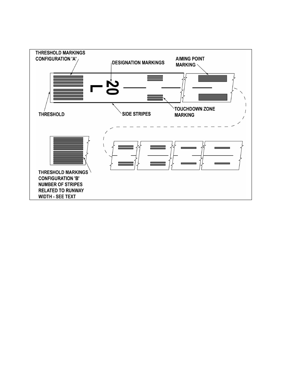
d. Runway Aiming Point Marking.
The aiming point marking serves as a visual aiming point for a landing
aircraft. These two rectangular markings consist of a broad white stripe located on each side of the runway
centerline and approximately 1,000 feet from the landing threshold, as shown in FIG 2
1, Precision
Instrument Runway Markings.
e. Runway Touchdown Zone Markers.
The touchdown zone markings identify the touchdown zone for
landing operations and are coded to provide distance information in 500 feet (150m) increments. These markings
consist of groups of one, two, and three rectangular bars symmetrically arranged in pairs about the runway
centerline, as shown in FIG 2
1. For runways having touchdown zone markings on both ends, those pairs of
markings which extend to within 900 feet (270 m) of the midpoint between the thresholds are eliminated.
2
−
3
−
2
Airport Marking Aids and Signs