4/20/23
AIM
Section 5. Aircraft Rescue and
Fire Fighting Communications
6
−
5
−
1. Discrete Emergency Frequency
a.
Direct contact between an emergency aircraft flight crew, Aircraft Rescue and Fire Fighting Incident
Commander (ARFF IC), and the Airport Traffic Control Tower (ATCT), is possible on an aeronautical radio
frequency (Discrete Emergency Frequency [DEF]), designated by Air Traffic Control (ATC) from the
operational frequencies assigned to that facility.
b.
Emergency aircraft at airports without an ATCT, (or when the ATCT is closed), may contact the ARFF IC
(if ARFF service is provided), on the Common Traffic Advisory Frequency
(CTAF)
published for the airport
or the civil emergency frequency
121.5 MHz.
6
−
5
−
2. Radio Call Signs
Preferred radio call sign for the ARFF IC is “(location/facility)
Command
” when communicating with the flight
crew and the FAA ATCT.
EXAMPLE
−
LAX Command.
Washington Command.
6
−
5
−
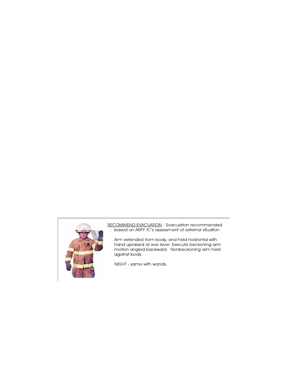
3. ARFF Emergency Hand Signals
In the event that electronic communications cannot be maintained between the ARFF IC and the flight crew,
standard emergency hand signals as depicted in FIG 6
3 should be used. These hand
signals should be known and understood by all cockpit and cabin aircrew, and all ARFF firefighters.
FIG 6
−
5
−
1
Recommend Evacuation
Aircraft Rescue and Fire Fighting Communications
6
−
5
−
1