4/20/23
AIM
FIG 10
−
2
−
5
Landing Zone Hazards
5.
Keep spectators back at least 200 feet. Keep emergency vehicles 100 feet away and have fire equipment
(if available) standing by. Ground personnel should wear eye protection, if available, during landing and takeoff
operations. To avoid loose objects being blown around in the LZ, hats should be removed; if helmets are worn,
chin straps must be securely fastened.
6.
Fire fighters (if available) should wet down the LZ if it is extremely dusty.
e. Helping the Flightcrew Locate the Scene
1.
If the LZ coordinator has access to a GPS unit, the exact latitude and longitude of the LZ should be relayed
to the HEMS pilot. If unable to contact the pilot directly, relay the information to the HEMS ground
communications specialist for relaying to the pilot, so that they may locate your scene more efficiently.
Recognize that the aircraft may approach from a direction different than the direct path from the takeoff point
to the scene, as the pilot may have to detour around terrain, obstructions or weather en route.
2.
Especially in daylight hours, mountainous and densely populated areas can make sighting a scene from
the air difficult. Often, the LZ coordinator on the ground will be asked if she or he can see or hear the helicopter.
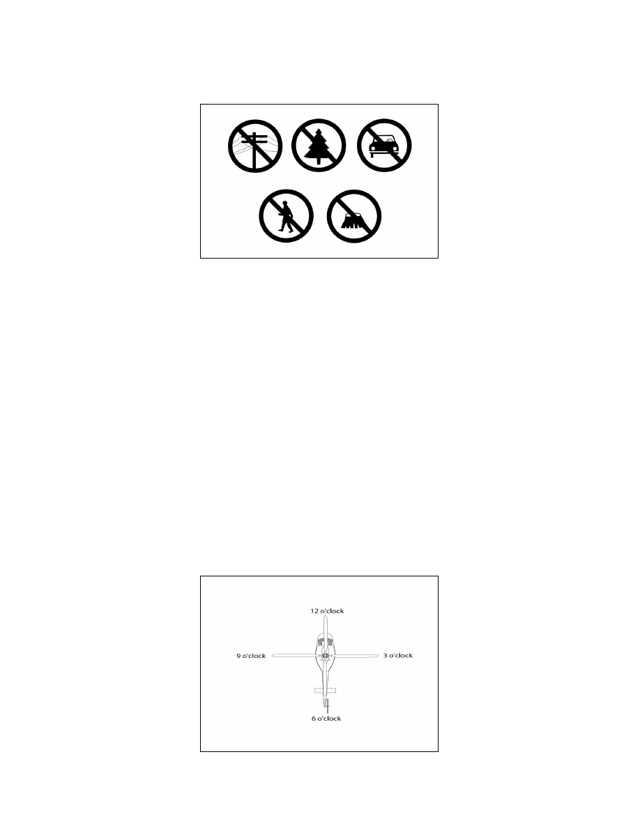
3.
Flightcrews use a clock reference method for directing one another’s attention to a certain direction from
the aircraft. The nose of the aircraft is always 12 o’clock, the right side is 3 o’clock, etc. When the LZ coordinator
sees the aircraft, he/she should use this method to assist the flightcrew by indicating the scene’s clock reference
position from the nose of the aircraft. For example, “Accident scene is located at your 2 o’clock position.” See
6.
FIG 10
−
2
−
6
“Clock” System for Identifying Positions Relative to the Nose of the Aircraft
Special Operations
10
−
2
−
13